Slate Peak SW, 7,440 feet, Okanogan County, WA. Slate Peak is in the North Cascades close to Harts Pass which at 6,206 feet is the highest pass in Washington that can be reached by automobile. Slate Peak is truly on the crest of the Cascades, as in one direction water drains into the Skagit River system, and in another direction north to British Columbia via the Pasayten River.
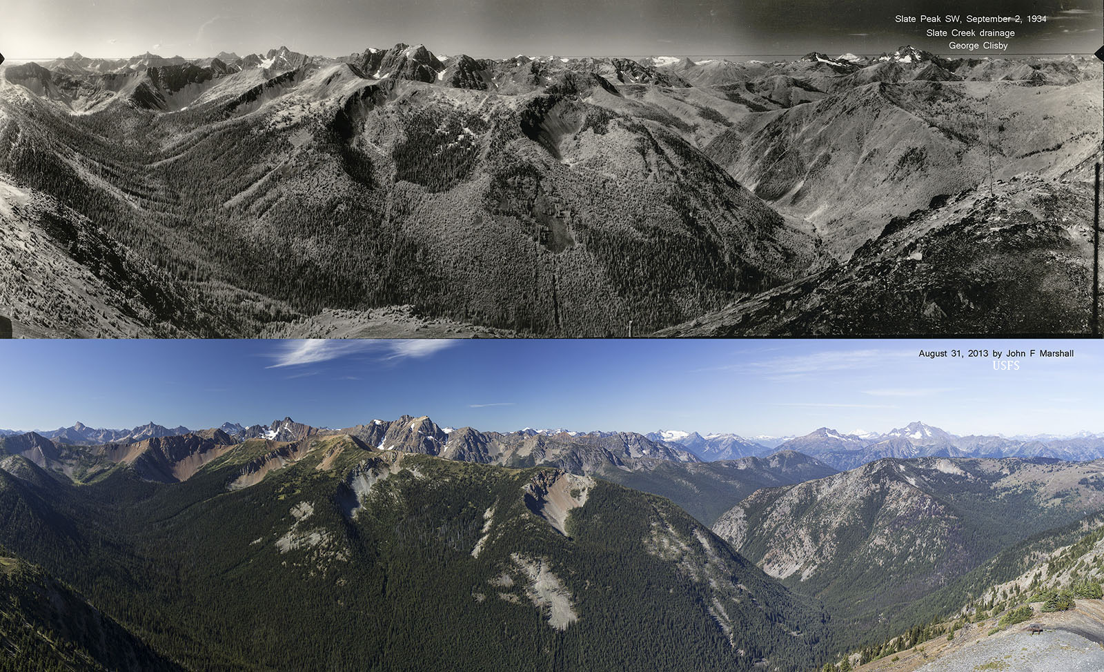
1934 USFS Photo by George Clisby from National Archives and Records Administration, Seattle, WA. 2013 photo by John F Marshall for Okanogan-Wenatchee National Forest and Wenatchee Forestry Sciences Lab.

Seventy-nine years of fire suppression has made a striking difference on the landscape, with sweeping implications for wildlife and future fires. The 1934 landscape was far more varied due to repeated fires. Without fire, tree cover has become much more continuous. There are few open areas today, which means less forage opportunity for grazing and browsing animals, and fewer berries for birds and bears. A fire today could spread a great distance without running out of fuel to burn. The landscape has the potential of flipping from mostly closed canopy forest to mostly burned and open with few patches of live trees. The ecologically richest landscapes have a mixture of vegetation, which comes about from periodic fires and other disturbances. Interrupting natural fire patterns has diminished biodiversity.
Slate Peak N, This sector looks at the view from 300 degrees to 60 degrees. The view is into the West Fork of the Pasayten River.

View from Slate Peak into the West Fork of the Pasayten River.
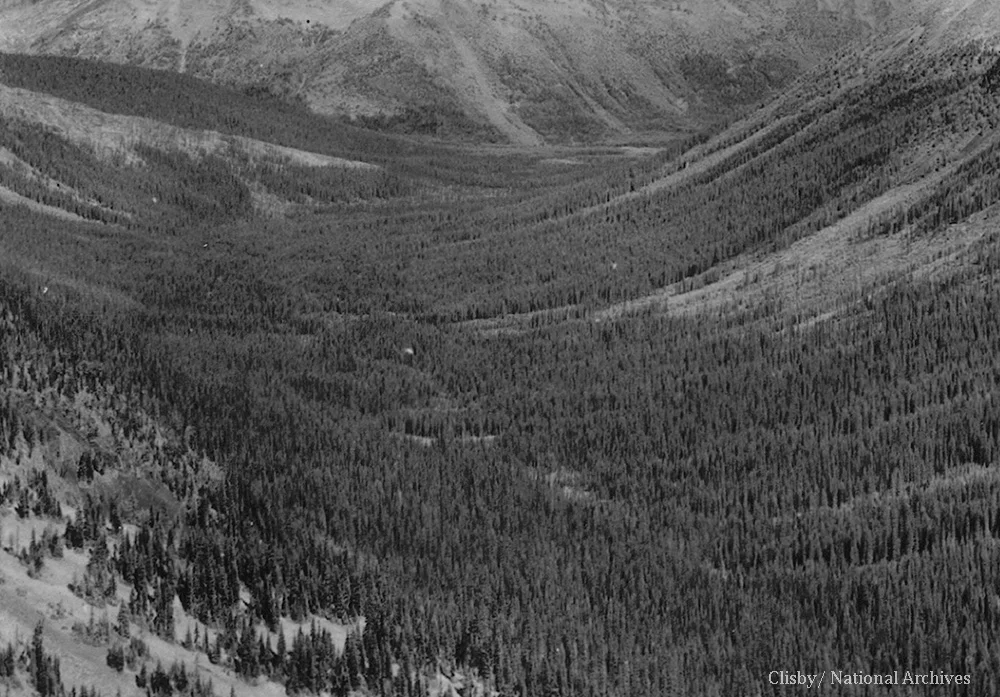
West Fork of Pasayten River drainage in 1934, as seen from Slate Peak

West Fork of Pasayten River drainage in 2013, as seen from Slate Peak
The character of the forest is stikingly different, comparing 1934 and 2013. Not only has there been less fire activity, but also less avalanche activity.